|
The main objective of this section hike was to
complete the 30 miles I was unable to hike last April due to remaining
heavy snow at Fuller Ridge in the San Jacinto Mountains. I would
once again hike from north to south, starting at Cajon Pass on Interstate
15 and finishing at the same place I ended last spring - the Tram
to Palm Springs.
The training ritual consisted of alternating biking
8 - 15 miles with walking 4-6 miles per day. Three weeks before
departure I would walk every 4th day, with the pack loaded to 25
pounds. I felt that I over trained last spring and created early
foot problems. The bike allowed me to keep in shape and go easy
on my knees.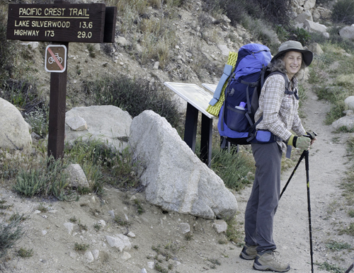
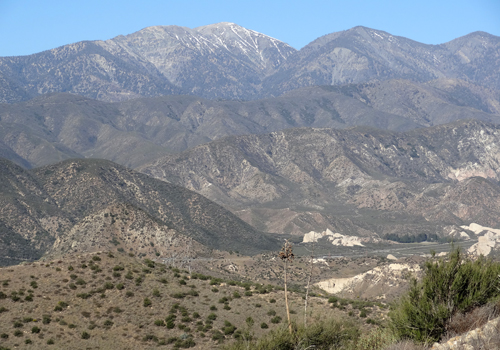
On Wednesday, April 10th my brother John drove
me to the trailhead, 20 miles east of San Bernadino on Interstate
15. Thank you John. I was at the trailhead and on my way by 7:30
am. The weather had been seasonably cool, but of course, the day
I left the forecast was for 80 degree+ temperatures. My brother
had mentioned the number of trains passing over Cajon Pass so naturally
all day I could hear, and see almost non-stop trains going up and
down the Pass. Unsure of camp sites around Silverwood Lake, I made
camp in a closed campground just outside Silverwood Lake State Park.
Even though it was closed there was running water available.
 The
next morning, as I left camp, I realized that I was getting blisters
again in the same places I had last spring. I had not gotten blisters
on my Southern Washington section hike in September wearing the
same boots, so I was surprised. It seemed that the combination of
hot weather, trail conditions, as well as Gor-tex boots was most
of the problem. My feet were plain getting too hot! Nothing I could
do about that now, so I would spend the next 5 days in pain once
again. At least I was prepared with lots of items to treat for blisters,
though nothing was going to make my feet feel better. The
next morning, as I left camp, I realized that I was getting blisters
again in the same places I had last spring. I had not gotten blisters
on my Southern Washington section hike in September wearing the
same boots, so I was surprised. It seemed that the combination of
hot weather, trail conditions, as well as Gor-tex boots was most
of the problem. My feet were plain getting too hot! Nothing I could
do about that now, so I would spend the next 5 days in pain once
again. At least I was prepared with lots of items to treat for blisters,
though nothing was going to make my feet feel better.
It was getting hot, as the true spring season
came to this desert region, and water was going to be scarce for
awhile.
About 10 miles down the trail, as I was gimping
along favoring my blistering feet, I put my uphill hiking pole down
and immediately heard a very load rattling sound. A rattlesnake!
With my sore feet, I must have been a funny sight as I tried to
jump to the side and get past my foe. I managed to get a quick look
and it was big, black and angry. A week later I was telling someone
about my encounter and they knew exactly where I had been. Apparently
several people have encountered this same snake defending its territory.
I managed to hike 12 miles on my second day, camping
along a running creek where I could soak my feet.
My daily routine in hot weather is to get on the
trail early, before the sun had ascended high enough to be truly
scorching. I'd hike 8 to 10 miles, find whatever shade I could,
take a long break, then continue later in the cooler afternoon.
As much as I wanted to be on the trail by 7:00 am, my morning foot
routine slowed me down. But each day my feet were slowly getting
better.
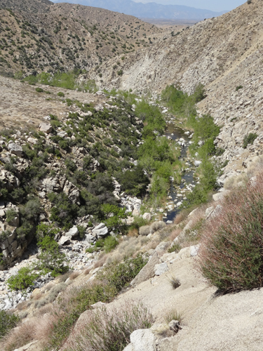 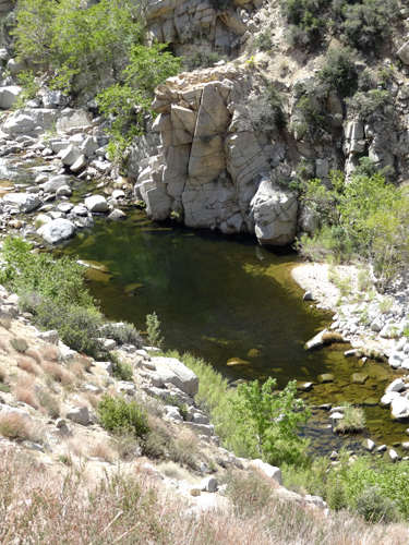 Day
3 and 4 were spent in Deep Creek, a fifteen mile canyon along a
beautiful creek lined with very inviting swimming holes. Unfortunately
the hot, dry trail was a steep 50+ feet above the creek and hiking
alone, with blisters, it wasn't safe for me to attempt getting down
for a swim. A popular hot springs lies about half way through the
canyon, and though I had only gone 10 miles on day 3, I decided
to stay, soak my feet and enjoy the scenery. The few people who
had made the steep hike down from the rim of the canyon were the
first people I had encountered since my departure. However none
were PCT hikers, but instead just out for a short hike to the hot
sprngs. Day
3 and 4 were spent in Deep Creek, a fifteen mile canyon along a
beautiful creek lined with very inviting swimming holes. Unfortunately
the hot, dry trail was a steep 50+ feet above the creek and hiking
alone, with blisters, it wasn't safe for me to attempt getting down
for a swim. A popular hot springs lies about half way through the
canyon, and though I had only gone 10 miles on day 3, I decided
to stay, soak my feet and enjoy the scenery. The few people who
had made the steep hike down from the rim of the canyon were the
first people I had encountered since my departure. However none
were PCT hikers, but instead just out for a short hike to the hot
sprngs.
Day 4 I was on the trail by 6:15 am, hiked the
remaining 10 miles along Deep Creek, and then began the ascent to
Big Bear along Holcomb Creek. As it was a Saturday, there were numerous
day hikers out for a swim or to fish. It was nice that evening to
camp among the pines of the San Bernadino Mts.
Up to this point I was disappointed in my progress.
During my first section hike I had planned on 10 mile days, but
averaged 14 miles. Section two I managed 15 mile days, yet now I
was struggling to complete 12 miles. I had allowed a few extra days
for unexpected delays so instead of beating myself up, I did what
I could and tried to enjoy the experience. This wasn't a race. Big
Bear was another twenty miles, and a lay day was planned with a
bed, shower and real meals.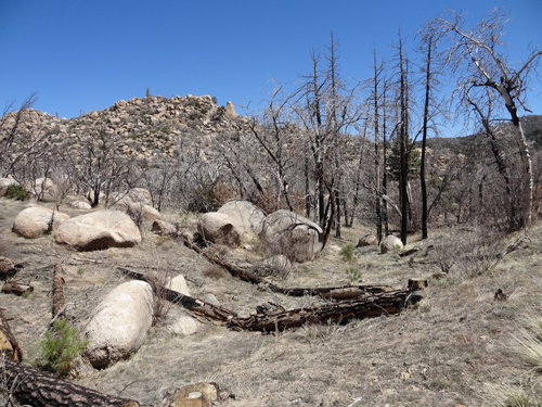
On Monday, April 15th, as I approached the road
I would take into Big Bear, I ran into a day-hiker, Tiffany, who
after a brief conversation invited me to stay at her house. The
offer sounded good to me, so I accepted. Tiffany would like to hike
the PCT and was very interested in what was involved and my experiences.
She's in the real estate business for a career, and the rest of
my day was spent tagging along as she helped friends look at rental
property.
 The
last time I remember being in Big Bear was probably the late-70's
when I came up to ski for the day with a friend. At that time there
was one small, local ski area, very much at the whim of the unreliable
weather. Now there are three big ski areas. Amazing how the ability
to make snow changes the game. The
last time I remember being in Big Bear was probably the late-70's
when I came up to ski for the day with a friend. At that time there
was one small, local ski area, very much at the whim of the unreliable
weather. Now there are three big ski areas. Amazing how the ability
to make snow changes the game.
I intended to spend one night and return to the
trail the next afternoon. But the forecast was for possible snow
showers, and the temperatures were dropping into the high 20's.
Tiffany also wanted to hike with me for a day, so I remained for
another night and woke up the next morning to a light dusting of
snow. I managed to get Tiffany on the trail by 9:15 am.
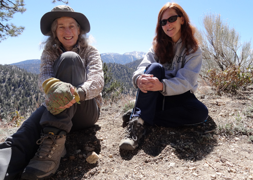 Since
Tiffany had hiked many sections of the PCT in the Big Bear area,
she wanted to hike a section new to her. That put me 20 miles from
where I had gotten off the trail, meaning I'll have to do that portion
on my next trip to So Cal to visit my mom. (See Update at bottom.) Since
Tiffany had hiked many sections of the PCT in the Big Bear area,
she wanted to hike a section new to her. That put me 20 miles from
where I had gotten off the trail, meaning I'll have to do that portion
on my next trip to So Cal to visit my mom. (See Update at bottom.)
It was a beautiful day, I felt refreshed and ready
to be back on the trail. My feet were definitely bette,r but now
my right knee was bothering me. This seemed strange since I hadn't
done any long downhill sections. On reflection, it was probably
the 3 days of trail with the downhill slope consistently to my left
and no variation for my knees. I should have been icing my knees
during the time off in Big Bear.
About 5 miles into the trail I was talking to
Tiffany, looking at Mt. San Gorgonio, when the next thing I knew
I was flat on my face. Bam! Eating dirt! I think the trail fell
away from my downhill foot and my left foot tripped over that foot,
while the weight of the pack pulled me down. When I'm on my own,
I'm very careful where I place my feet, as usually there isn't anyone
to help if I make a mistake. Luckily Tiffany was with me, and helped
me get cleaned up and bandaged the gash I now had on my nose and
forehead. I don't think the fall helped my right knee!
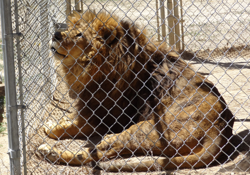 Along
this section of the trail is the home to movie industry stunt animals
- lions, tigers, brown bears and a few other creatures - all enclosed
in a large chain linked fence, and in visible cages. As we approached
the fence a guard dog came towards us barking. All of a sudden ALL
of the cats began roaring. The sound was incredible - and very scary.
I couldn't help but wonder the impact it would have in the wild! Along
this section of the trail is the home to movie industry stunt animals
- lions, tigers, brown bears and a few other creatures - all enclosed
in a large chain linked fence, and in visible cages. As we approached
the fence a guard dog came towards us barking. All of a sudden ALL
of the cats began roaring. The sound was incredible - and very scary.
I couldn't help but wonder the impact it would have in the wild!
Tiffany turned back for home about a mile from
my destination for the night (Thank you Tiffany for your great hospitality!),
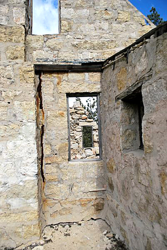
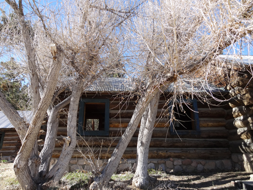
Coon Creek Cabin, the first school house in the Big Bear area, or
so I was told and not confirmed. The old school sits with two other
cabins on a ridge overlooking the Coachella Valley. The windows
and doors have long been gone, but since it was going to be a cold
and windy night I slept inside to get some shelter from the elements.
 My
knee was really bothering me when I got up the next morning, and
my concern was that it would be troublesome, as I had a 5,000 ft.
descent in the next 35 miles. I considered hiking out to the road,
but just couldn't give up yet. "Cowboy up and keep on going", I
told myself, and I continued on. It was a slow, painful, careful
hike down almost 3,000 ft., but I managed 12 miles to my next camp.
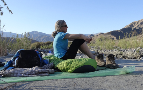
On this stretch of trail I met four PCT thru-hikers, my first since
I began, hiking the opposite direction. And even though there were
now hikers on the trail, I had another solitary campsite beside
Mission Creek. My
knee was really bothering me when I got up the next morning, and
my concern was that it would be troublesome, as I had a 5,000 ft.
descent in the next 35 miles. I considered hiking out to the road,
but just couldn't give up yet. "Cowboy up and keep on going", I
told myself, and I continued on. It was a slow, painful, careful
hike down almost 3,000 ft., but I managed 12 miles to my next camp.
On this stretch of trail I met four PCT thru-hikers, my first since
I began, hiking the opposite direction. And even though there were
now hikers on the trail, I had another solitary campsite beside
Mission Creek.
 The
morning of day 10 found me hobbling down the trail. It was going
to be a long, painful day. I hadn't been on the trail more than
an hour when I met another hiker coming up the trail, Ed from Bellingham.
Ed was going to resupply in Big Bear but was a little short on food.
I gladly gave him a few extra meals, and in exchange he gave me
a pain killer for my knee! I'm very naive about drugs, taking mostly
only aspirin. But Ed had a white pill he said he took every morning
with his coffee. I really didn't know what I was taking, but within
a hour I was almost skipping down the trail. I continued to be very
careful but felt no pain and managed 15 miles!. I camped beside
the Whitewater Creek, rinsed out clothes and enjoyed the evening. The
morning of day 10 found me hobbling down the trail. It was going
to be a long, painful day. I hadn't been on the trail more than
an hour when I met another hiker coming up the trail, Ed from Bellingham.
Ed was going to resupply in Big Bear but was a little short on food.
I gladly gave him a few extra meals, and in exchange he gave me
a pain killer for my knee! I'm very naive about drugs, taking mostly
only aspirin. But Ed had a white pill he said he took every morning
with his coffee. I really didn't know what I was taking, but within
a hour I was almost skipping down the trail. I continued to be very
careful but felt no pain and managed 15 miles!. I camped beside
the Whitewater Creek, rinsed out clothes and enjoyed the evening.
 It
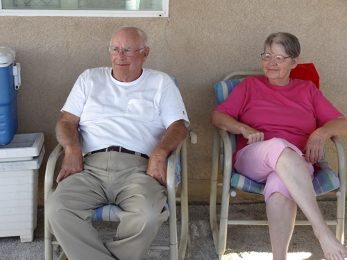
was only 8 miles to Trail Angels Ziggy and Bear's house in Cabazon
off Highway 10, outside Palm Springs. I arrived about 11:30 am and
spent the rest of the day taking a shower, eating, including a large
bowl of ice cream provided by Bear, and relaxing. They are an amazing
couple. They first became Trail Angels when they lived in Anza,
CA, 5 miles off the trail. They specifically bought the house they
are in now because it is literally right on the PCT. During the
height of the season they've had as many as forty hikers camped
in their backyard. Being early in the season, there were only 10
hikers that night. It
was only 8 miles to Trail Angels Ziggy and Bear's house in Cabazon
off Highway 10, outside Palm Springs. I arrived about 11:30 am and
spent the rest of the day taking a shower, eating, including a large
bowl of ice cream provided by Bear, and relaxing. They are an amazing
couple. They first became Trail Angels when they lived in Anza,
CA, 5 miles off the trail. They specifically bought the house they
are in now because it is literally right on the PCT. During the
height of the season they've had as many as forty hikers camped
in their backyard. Being early in the season, there were only 10
hikers that night.
Trail names are something that most hikers are
given along the trail. At this point I didn't have one. But Bear
came up with one and it stuck - Hike Alone. So I now officially
have a trail name.
The next 32 miles were the ones I wanted most
to complete, the section I was unable to hike last year. My plan
was to do the first 5 miles, across the desert floor, very early
in the morning before the sun became too intense. Then I'd wait
at the bottom of the ridge, literally hiding in the shade under
a large rock, and begin the 6,000 ft. climb late in the afternoon
as the sun was going down.
I arrived at my rock by 9:30 am. There is a drinking
fountain there, put in by the local water district, and the first
water in twenty miles for those coming down the ridge. The day was
spent visiting with the hikers coming down and imparting information
on the trail ahead. At 4:30 pm I began the 6,000 ft. ascent up the
trail. The moon was going to be 3/4 full that night and I was hoping
to get in a few hours of hiking after sundown.
By 8:00 pm it was getting dark enough that it
was becoming difficult to see the trail. My headlight wasn't really
illuminating the trail well enough, and the moon wasn't yet high
enough to provide adequate light. I knew that there was a camp site
close by and proceeded very slowly, along steep sides, through rough
areas of thick brush, until about 9:15 pm when I spotted a potential
camp site. Of course by now the moon was fully out and shining down
on me like a headlight! I was glad to get my sleeping bag down and
get some sleep.
 I
was on the trail by 6:00 am to beat the sun and complete the next
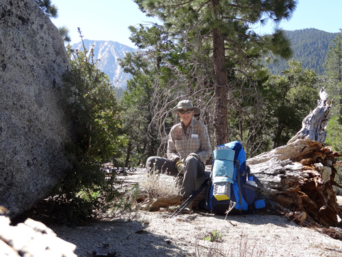
5 miles of trail in the open. By 9:00 am I was finally in the trees
on the final approach to Fuller Ridge, and by 12:15 pm I was at
the Fuller Ridge Trail head at 7,761 ft. Since I had an extra day
to spare, I decided to make camp, and do the 5 miles of Fuller Ridge,
with it's many snow banks, the next morning while my legs were fresh. I
was on the trail by 6:00 am to beat the sun and complete the next
5 miles of trail in the open. By 9:00 am I was finally in the trees
on the final approach to Fuller Ridge, and by 12:15 pm I was at
the Fuller Ridge Trail head at 7,761 ft. Since I had an extra day
to spare, I decided to make camp, and do the 5 miles of Fuller Ridge,
with it's many snow banks, the next morning while my legs were fresh.
The afternoon was spent talking with hikers heading
down and giving them advice on potential camping sites. By evening
there were 6 other people camping in the same spot; my the first
night in camp with other hikers. But everyone was tired and just
wanted to settle down, so instead of having some evening companionship
I was once again alone.
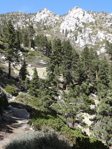 My
last full day of hiking was along Fuller Ridge and through the San
Jacinto Forest. All in all a great day. I wanted to spend my last
night in the same camp spot I spent last spring in Skunk Cabbage
Meadow, but I couldn't exactly find the spot. After setting up camp,
I went looking for water and found the site but decided to stay
where I was. My
last full day of hiking was along Fuller Ridge and through the San
Jacinto Forest. All in all a great day. I wanted to spend my last
night in the same camp spot I spent last spring in Skunk Cabbage
Meadow, but I couldn't exactly find the spot. After setting up camp,
I went looking for water and found the site but decided to stay
where I was.
Wednesday, April 24th was my last day on the trail,
only five miles to the Tram. The plan was to find a ride once again
from one of the many tourists on the Tram into Palm Springs. I left
at 7:30 am and found myself at the Tram by 10:30 am, only to realize
people were only just arriving at the top of the Tram. I figured
I might have to wait awhile before I found a ride. But fortunately
I met a young English couple heading down and asked if they could
give me a ride.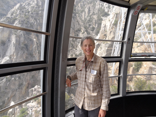
They were both doctors and had just completed
all of their required clinical practicum and were celebrating by
giving themselves a trip to the music festival in Indio. They were
now on their way to Laguna Beach and during our short ride into
Palm Springs I talked them into taking the Palms to Pines back road
to the San Juan Capistrano Mission, then onto the beach.
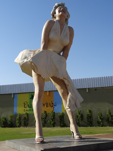 Once
again I stayed at the Chase Hotel, owned by our friend Craig Blau.
Great place to stay if you want to be in downtown Palm Springs!
Thank you again Craig for your very generous hospitality. Once
again I stayed at the Chase Hotel, owned by our friend Craig Blau.
Great place to stay if you want to be in downtown Palm Springs!
Thank you again Craig for your very generous hospitality.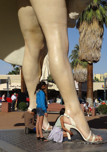
So I have now completed the first 342 miles in
Southern California, 148 miles in southern Washington, and I hope
to complete 186 miles in southern Oregon in September. But I'll
have to see how my knee heals up while I work on a treatment plan.
Perhaps the summer on our boat will allow the knee a good long forced
rest.
 Update Update
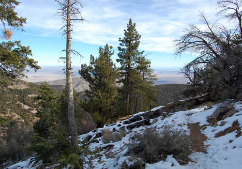
On December 1 and 2, 2013 I was able to complete
the 20 miles between mile 255.5 and 275 that were bypassed in April.
A big storm had dropped snow in the area 10 days prior and the trail
on north facing slopes still had quite a bit of snow. Having Mark
along in the car was a great advantage for getting off and on the
trail. And the day after I completed the section another storm came
through dropping more snow. I was really glad to finally have that
section complete.
|
